
Rail disruption warning as Storm Austen heads to Lancashire and across UK on Friday

Storm Austen is heading to the UK on Friday and Lancashire rail users are being advised to keep a careful eye out for disruption.
The Met Office has named its first storm of the season and Austen is likely to bring disruption across transport networks on Friday.
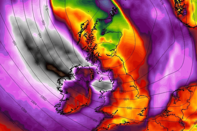

Although Lancashire is unlikely to bear the brunt of the first wave of the storm, heavy rain and gales are expected and the rail network in particular likely to be impacted. The storm’s course is not yet set in place.
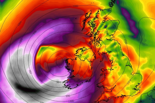
Storm Austen is forecast to bring gusts of 50-60mph to southern areas of the UK at the end of the week, with 70mph possible along exposed coasts. The South West, Ireland and Scotland are likely worst to be hit with weather warnings in place. The storm is being It is being blown towards the UK by a powerful jet stream across the Atlantic.
National Rail is advising travellers to check entire journeys before setting off. When using the National Rail real-time ‘Journey Planner’, please take note of any service updates that may be showing with a warning triangle.
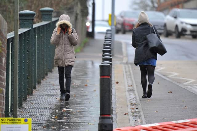
It says the forecasted weather may cause trains to be disrupted:
- High winds can mean trains have to run at slower speeds than usual to operate safely
- Strong winds can also bring down trees and other debris that blocks tracks and damages power lines
- Heavy rainfall can cause flooding that results in tracks being underwater and embankments being damaged
- Flooding can affect points, which allow trains to move from one line to another, and electrical systems
Met Office deputy chief forecaster Tom Crabtree said: “While the exact track and position of Storm Austen is still being determined, what’s clear is that we have an impactful period of weather on the way and the potential for disruption in places, which has resulted in the system being named.
“Peak gusts in excess of 70mph are possible on the most exposed coastal areas, while 50-60mph are likely more widely within the warning area. Weather warnings are under constant review and could be updated as confidence increases, so it’s important to stay up-to-date with the forecast in the coming days.”
Why do the Met Office name storms?
The Met Office storm year runs from September to August, with each 12-month period having its own alphabetical list of names that are used to label successive storms. This year’s list begins with Austen and continues with Boelo, Chloe, Dano and Evelyn, ending at W with Wende. The letters Q, U, X, Y and Z are not used, in line with international storm naming conventions.
The names are decided by the Met Office in conjunction with Met Éireann and KNMI, which are the Irish and Dutch national meteorological services respectively.
Austen was selected by Met Éireann in honour of Austen Nagle, the first director of the service, while Evelyn was picked in tribute to Evelyn Murphy, the first woman to present the weather on RTÉ, Ireland’s national public service broadcaster.
Other names are chosen from suggestions submitted by the public, with Chloe having been nominated more than 130 times. The Met Office began naming storms in 2015/16, since when the furthest letter of the alphabet reached within any 12-month period was L, in 2023/24. Only four storms were named in 2025/26: Amy, Bram, Chandra and Dave.
Met Office head of warnings and guidance, Holly Clements, said: “For more than a decade, storm naming has helped us communicate the risks from severe weather more effectively.
“A named storm provides a clear focus for forecasts and warnings, helping more people understand the potential impacts and take action to protect themselves, their families and their property.”