Weekend Walk: Loggerheads


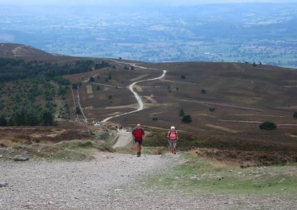
Wales is another country but one not so far away as might be imagined. Last month the Norwest Fellwalking Club went to Loggerheads Country Park just across the border near Mold. Our journey time from Leyland was a little over an hour similar to our ususal haunts in Lakes and Dales. Loggerheads is a remarkable place located in an area of limestone scenery with dramatic cliffs protruding through broadleaf woodland – beautiful at this time of year. Added to this it lies close to the foot of the Clwydian Range allowing for an ascent of Moel Famau their highest point as described below.
WALK FACTS
Start: Loggerheads Country Park CH7 5LH


Distance: 9 miles
Time: 4 – 6 hours
Grade: Stenuous because of the ascent of Moel Famau but the rest of the route is easy distance apart. There are a number of stiles especially in the fields after Cilcain.
Maps: OS Explorer 265 Clwydian Range
DIRECTIONS
Advertisement
Hide AdAdvertisement
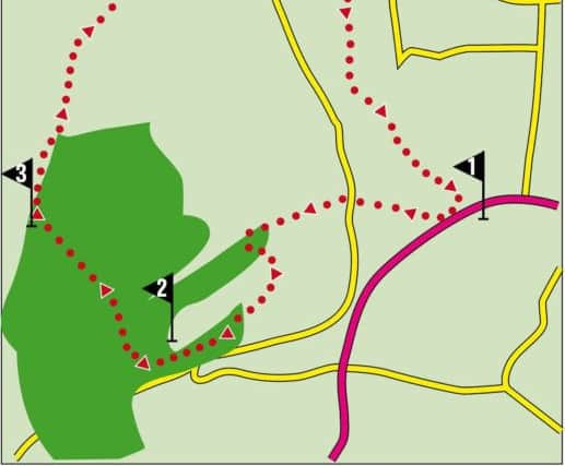
Hide Ad1. From the car park on a lane just off the A494 return to the lane and turn right quickly passing the overflow car park unless you’ve started from it. Keep on the lane for a little under ½ mile to reach a T junction. Turn right. Walk a short distance downhill and then turn left onto footpath in the direction of Moel Famau. A broad gravel drive leads gently upwards alongside wooded Aber Eilun – a stream to the right. In half a mile the drive turns left towards a large property. Here go through a metal gate and bear left crossing the corner of a field to reach a stile leading onto a path on the edge of woodland. Over the stile turn right but almost immediately take the path to the left of a fork. Now in trees keep on the path as it climbs and then switches back going left to arrive at a wide forest track after 350 yds. Turn left. Keep on this as it contours around a spur for 600yds to reach a junction of tracks. Here keep ahead on a narrower path signed for Jubilee Tower. Keep ahead on this as the ground to the left becomes progressively steeper passing through woodland until you arrive at an area of more open ground some 15 minutes later.
2. At a junction of paths turn right on a tourist track indicated by a waymarked post. From this point follow the track as it leads upwards to Jubilee Tower on the summit of Moel Famau (554m/1821ft) just over a mile from this point. As you approach your objective you are offered a less steep alternative to the left which if you decide to take it will had another ¼ mile to the walk.
3. Moel Famau is crowned with a remarkable structure – the base of what was a Jubilee Tower celebrating the 50 years of King George III’s reign in 1820. The construction of the tower was beset by problems and in an incomplete state it was toppled by a major storm some 50 years later. Now what remains provides a very popular viewing platform with a wonderful panorama taking in Merseyside, the Wirral, Deeside, the coast of North Wales, Snowdonia and deepest Wales. The route continues taking the footpath to the right of the Offa’s Dyke LDP heading north towards a conifer plantation. Now on the Clwydian Way keep on it crossing a bridleway on the far corner of the plantation and then carry on down the (very) steep slope towards a small reservoir. After the path flattens out pass the reservoir following a service track to a crossing of ways. Bear slightly left to cross a stile and then keeping to the hedge on the right continue across two fields. Cross a stile onto a track, turn left and almost immediately go right to reach a bend on a lane. Keep left for the village of Cilcain.
4. Cilcain is a pleasant village with the essential church and pub. After passing both turn right onto a lane in the direction of Llanferes. As the lane nears a bend to the left turn left through a kissing gate into a Woodland Trust reserve. On exiting the wood keep ahead alongside the wooded course of a stream to the right cross a succession of fields (and stiles) until you reach a lane. Turn right. The lane leads across the River Alyn. (As this is limestone country do not be surprised if the riverbed is dry – especially in the summer months.) On the far side follow the lane as it bends left and then right to climb steeply away from the river. As the lane levels out turn sharp right onto the Leete Path that leads towards the Devil’s Gorge. This high level narrow path will take you all the way back to Loggerheads passing impressive limestone cliffs on route and within delightful broadleaf woodland which in autumn offers a spectacle to rival the fall of New England.
- Walk checked members of the Norwest Fellwalking Club.