
'Bleak' Preston playing fields' flooding problems to be tackled
The flooding problems that render a community green space in rural Preston unusable after wet weather are finally set to be resolved.
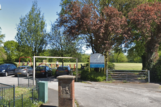
The King George V Playing Fields in Broughton are in line for a wider revamp that it is hoped will finally deal with the substandard drainage that has blighted the site for years.
The works, proposed by Preston City Council, will also see the extension of the existing car park at the Garstang Road facility and the upgrading – and relocation – of its children’s playground.
New footpaths, lighting and CCTV are all set to be installed, while “landscaping enhancements” are also in the pipeline.

According to a planning application by the city council – which will be determined by the authority’s own independent planning department – the overhaul aims to address a glut of issues that have caused “frustration” amongst local residents at not being able to access the facilities “comfortably and regularly”.
A draft policy in the Broughton-in-Amounderness Neighbourhood Plan described the playing fields as “an underused resource”, because of how easily they flood.
“It is an attractive green space on a dry sunny day, but with little other than a large expanse of grass, it becomes a wet, bleak and uninviting space in other seasons and weathers,” the document states.
“The playing fields do not have particularly good pedestrian access for residents, this being restricted to two entrance points on Garstang Road away from the main concentrations of housing.
“The small parking area on the Garstang Road frontage, the only public facility within the village, is too small to accommodate the demand for parking,” it adds.
A local youth team uses the football pitch when it can, while buildings on the site act as changing rooms and are the base for a pre-school and guides group.
The main source of flooding comes from surface water, the planning application states. Although the majority of the location is judged to be “at very low risk”, there is a known problem affecting the south of the plot.
It is thought to be connected to a “depression” in the land at that point and a culverted watercourse, which appears to have “a lack of capacity” that leads to the “ponding” of surface water on the grass above it.
Although it is expected that the new drainage infrastructure planned as part of the overhaul will help rectify the problem, a CCTV survey of the culvert is also being proposed to check that it is free from blockages or damage which could be contributing to the issue.