Weekend walk: Upper Wharfedale


Here’s a shocking statistic for you – 75% of British school children spend less time outdoors than prison inmates. This is based on a survey of parents from 10 countries and widely reported in the press. As with all studies like this the results must be viewed with a degree of caution but nonetheless they point to a worrying trend that we are raising a generation of young people in conditions of battery chickens. I have moaned in this column before about the malign effect of the school run where kids are dropped off at the school gates and so are deprived of the pleasure of walking. What is so depressing about the confinement of children to watching screens indoors is that the remedy is so close at hand especially in the North West of England where most of us live less than 20 minutes away from the countryside and some of it is high quality countryside at that, as this walk in the Yorkshire Dales proves. And yes I did take my children there when they were young and I intend taking my grandchildren there…when they are potty trained!
WALK FACTS
National Trust Pay and display car park Buckden BD23 5JX Grid ref: SD 941 771


Distance: 5miles
Time: 2 - 3 hours
Advertisement
Hide AdAdvertisement
Hide AdGrade: Mainly easy with one steep climb onto the escarpment above Scar House.
Map: OS OL 30 Yorkshire Dales Northern & Central area
DIRECTIONS
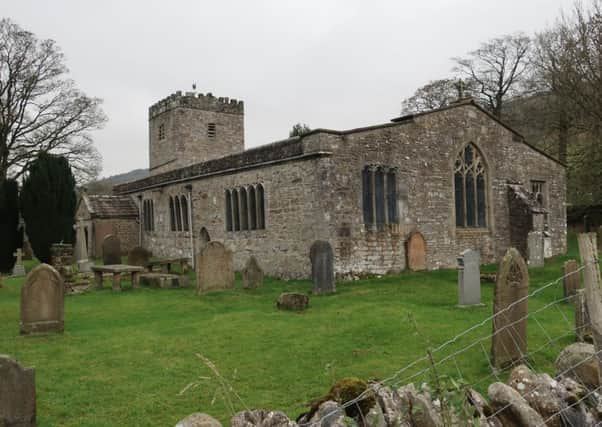
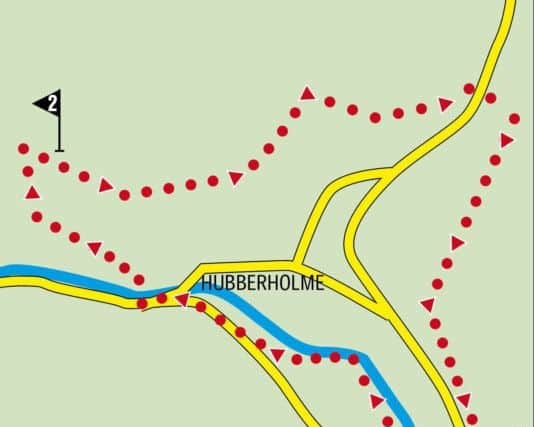
1.From the car park turn left towards the village and then right onto a track that cuts a corner to put you on Dubb’s Lane. Turn right crossing the River Wharfe and soon after turn right again onto a footpath that is the Dales Way. This is one of the country’s most popular long distance paths (LDP) linking Ilkley with Bowness on the shores of Windermere. Regrettably this route only uses a mile or so of it. You’ll have to leave the other 81 for another occasion. Follow the path alongside the Wharfe until it brings you back to Dubb’s Lane. Turn right and enter the village of Hubberholme. Just by the George Inn turn right crossing the river to arrive at the church. Dedicated to St Michael and All Angels this ancient building has pews made by the woodcraftsman Robert Thompson of Kilburn some of which are adorned by his trademark mice carved discreetly here and there. You can spend a happy hour looking for them. The grounds provide a resting place of the ashes of dramatist and author J.B.Priestley. Our route edges to the right of the churchyard and after going through a farm gate turns left onto a drive taking you up to Scar House. The drive climbs away from the valley and bends to the right to continue steeply to the farm complex. When you reach it turn right past the farm house and then follow a rough track taking you onto the limestone escarpment that gave Scar House its name.
2. As you reach a signpost turn right in the direction of Cray. After picking your way across a band of limestone follow the clear path as it takes you across pastureland contouring above the treeline. The view southwards down towards Kettlewell is magnificent. Keep on this path as it brings you to a footbridge over Crook Gill and then continues along a grassy shelf bearing left through a gap close to a field barn. The path brings you to a farm track on the edge of Cray. Follow this to reach the B6160 at the White Lion. Should you decide to sample this welcoming inn you’ll find no objection here but to complete the walk you need to cross the road to a footpath that leads down to stepping stones across Cray Gill. Once over these climb steeply up to a gate that places you on a broad track below Buckden Pike. Turn right for the car park just over a mile away. This path now forms part of one of Britain’s newest LDPs ‘Wainwright’s Pennine Journey’ which recreates the route taken by Alfred Wainwright (later famed for his ‘Pictorial Guide to the Lakeland Fells”) in 1938 when he walked from Settle up to Hadrian’s Wall and back again. [Note: If Cray Gill is in full spate making the stepping stones risky to cross you have two options. The pleasantest one is to turn left walk up the road 600yds to Cray High Bridge cross it and turn right onto the Buckden track there. Alternatively turn right and follow the road downhill.]
- Bob’s walks are now available as digital guides on the iFootpath website and App (see iFootpath.com).