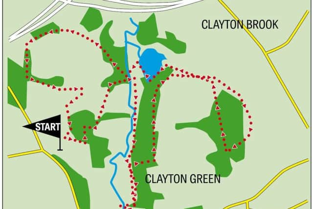
Weekend walk: Cuerden Valley Park


Cuerden Valley Park is something of a miracle. Surrounded by urban development and busy roads this green corridor offers all the benefits of the countryside in a tranquil haven tucked between South Ribble and Chorley. Here John Hargreaves describes a walk to give the first time visitor a perfect introduction to this hidden gem.
Overview
A four mile circular of Cuerden Valley Park which lies between Bamber Bridge and Clayton Green. It has 650 acres of parkland, wildflower meadows, mixed woodland, the meandering River Lostock with stepping stones and a ford, oxbow ponds, a lake, a picnic area, ten miles of paths, and a section of the National Cycle Route. There is also the Pinetum (plantation of conifers for ornamental purposes) and the Victorian Walled Orchard.
Walk facts
Advertisement
Hide AdAdvertisement
Hide AdStart Point: Berkeley Drive car park, Bamber Bridge, Preston PR5 6BY. Roadside car parking is ANPR Pay & Stay where you type in your car registration number before paying by coins or card. Charges in 2018 were £1.10 for up to 2 hours, £2.20 for up to 4 hours, £4 all day.
Distance: 4.2 miles circular anti-clockwise
Time: Around 2 hours
Grade: Easy; metalled roads and tracks, gravel footpaths, some muddy patches, six flights of steps, gates, but no stiles.
Map: OS Explorer 1:25,000 286 Blackpool & Preston
Directions
1.From the roadside car park go along the lane to the new Visitor Centre and Café which opened in June 2018. It is constructed with a timber frame, straw bale walls, and a curved window to the front with a wonderful view of the parkland and river.
Go past the Centre through the gate and along the lane to cross the River Lostock using either the bridge or the ford, depending on the depth of the water, the height of your boots, and your sure-footedness! Turn right along the track (part of the Ironbridge to Preston National Cycle Route 55) and follow the river upstream and get a great view of the Visitor Centre on the hill. Ignore the track on the right to the footbridge to reach a T junction in the wood (if you wish to see the large stepping stones across the river turn right along the cycle track for another 300 yards. Just before a stone gatepost and drainage gully turn right into the wood to see the stepping stones. Retrace your steps to continue the route).
Advertisement
Hide AdAdvertisement
Hide AdTurn left up the hill for 140 yards and just before the gate into the field turn left into the wood. Continue for 450 yards to turn right along Cam Lane through the gate. Ignore the track down the steps to your left. When you reach the gate at the entrance to Green Wood keep left down the slope.
After crossing the footbridge over a drainage channel fork right to avoid taking the steps up towards Hawks Clough. Cross another footbridge and go up a long flight of steps then turn right along the edge of a field. Continue past the gate into ASDA, through the wood, down some steps, across another footbridge, up a long flight of steps and turn right on to Cam Lane.
Pass the Mediterranean-themed Cam Lane Cottage and its hardy palm trees. Continue along Cam Lane and as it goes down the hill fork left through the gate to join (in reverse) the route taken earlier.
In 200 yards turn right down the steps towards the lake, through a gate and over a footbridge into the wood. Follow the track around the lake and at the end of the path turn left down the steps across the picnic area and footbridge over the river. Immediately turn right along the cycleway for 800 yards through Cock Robin Wood. Keep towards the left edge of the wood ignoring all paths to the right.
Advertisement
Hide AdAdvertisement
Hide AdAt the footbridge over the M6, do not cross it but turn left down the steps. Go through two gates and along the high-walled path for 250 yards through Cinder Path Wood. This was constructed in the 1800s so, it is said, the landowner Robert Townley Parker would not see the hoi polloi using this ancient right of way crossing his estate.
At the blocked off subway under the road go up the steps and turn left for 300 yards to Cuerden Hall, which is now a Sue Ryder specialist neurological care centre. Continue along the garden path around the Hall to Berkeley Drive. Turn right then immediately turn left opposite the electricity sub-station along a narrow path through the wood. Where the path exits into the car park turn right to the Walled Orchard. From the orchard follow the path through the Pinetum to the car park.
Points of Interest
Cuerden Hall dates from around 1200. Over the years ownership passed through the Molynuex, Binastre, Parker, Townley-Parker families and latterly to Reginald Arthur Tatton. In WWI it was used as a Red Cross Auxiliary Hospital for injured soldiers. In WWII it was occupied by the Army and later sold to the MoD to house the Army HQ (NW). In 1977 it became the HQ of the CLDC and in 1990 opened as a Sue Ryder care home.
In 1992 ownership of the Park was handed over to the Cuerden Valley Park Trust, the charity that now manages the Park.
- Walk devised and described by John Hargreaves.
- Bob’s walks are now available as digital guides on the iFootpath website and App (see iFootpath.com).