Storm Pia set to batter Lancashire and disrupt Christmas travel plans with winds of up to 70mph
and live on Freeview channel 276
A notably deep area of low pressure will track to the north of the UK over the Norwegian Sea through Wednesday night and into Thursday.
This is expected to bring very strong winds and heavy showers to a large portion of the UK.
Advertisement
Hide AdAdvertisement
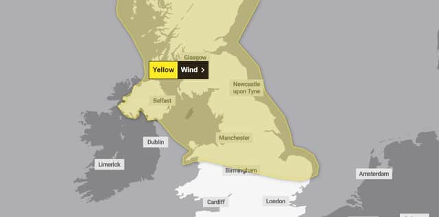
Hide AdThe Met Office has subsequently updated a yellow weather warning covering a large swathe of the country, including all of Lancashire.

Met Office Chief Meteorologist, Paul Gundersen, said: "We've issued a large yellow warning area where there’s a potential for some impacts, but gusts of 50-60mph are possible for large parts of central and northern areas of the UK.
"Exposed coasts and high ground could see gusts of 70-80mph at times, mainly across the far north of Scotland.
"There's a chance this low pressure will continue to exert its influence into Friday, so it’s important to stay up to date with the latest Met Office forecast."
Advertisement
Hide AdAdvertisement
Hide AdThe weather warning will be in place from midnight until 9pm on Thursday (December 21)
It also comes with a caution for Brits heading home for Christmas ahead of the weekend, saying that they should expect travel disruptions on roads and train services.
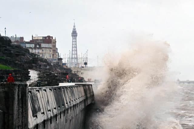
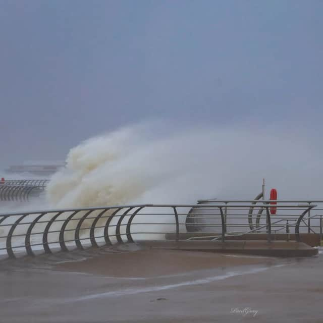
Forecasters are also urging people on the coast to be aware of large and potentially life-threatening waves.
The Department for Agriculture, Environment and Rural Affairs has advised the public not to visit forests, country parks, and nature reserves until the winds subside.
Advertisement
Hide AdAdvertisement
Hide AdIt remains generally rather unsettled for the weekend before Christmas, with further Atlantic frontal systems bringing rain and strong winds to parts of the UK.
Rain will be heaviest in the west and northwest through the weekend, with any snow most likely confined to high ground in northern Scotland.
Some central and eastern areas of the UK could remain mostly dry.
There are still some uncertainties in the details of the forecast for Christmas Day, as Paul explained: "Christmas Day looks like being fairly unsettled in northern and western areas.
Advertisement
Hide AdAdvertisement
Hide Ad"Any showers in the north could be wintry with hail and thunder, but even here, any snow will be mainly on high ground.
"While temperatures will be near normal for the time of year it will be a windy day for many, meaning it will feel colder."
Comment Guidelines
National World encourages reader discussion on our stories. User feedback, insights and back-and-forth exchanges add a rich layer of context to reporting. Please review our Community Guidelines before commenting.