
Latest Lancashire weather updates as Storm Goretti sweeps across UK

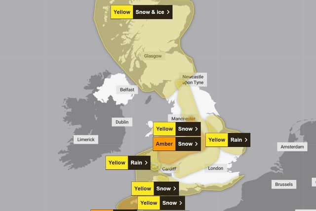
Lancashire is bracing for a further spell of wet and windy weather as Storm Goretti sweeps across the UK today, with eastern parts of the county at risk of further snowfall.
Coastal areas and central Lancashire will be spared the worst of the storm, but a yellow warning for snow remains in place for Burnley, Nelson, Colne, Bacup and surrounding areas until midday.
In Preston, Chorley, South Ribble and the Fylde coast, it’s expected to be cloudy, cold and wet with rain or sleet at times. There might be occasional flurries of light snow over higher ground.
Traffic & travel latest
As of 9am, all trains are on time at Preston and Blackpool North stations, while the M6, M55 and M65 motorways are fully open with no incidents reported.

How much snow could fall?
The Met Office says 5–10cm of snow is likely in areas covered by the warning, with 15–25cm possible in places above 200 metres, but is expected to turn to rain and sleet in the afternoon.
A spokesperson said: “There is some uncertainty over the exact track of Storm Goretti, which will influence the locations most likely to see disruptive snow.
“Amounts will also depend heavily on elevation and precipitation intensity, leading to a mix of rain, sleet and snow.”
Join our WhatsApp Community to get the latest news and top stories from across Lancashire directly to your phone
Today
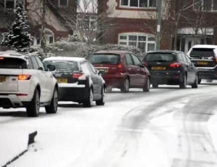
Cloudy, cold and wet with rain or sleet at times, occasionally falling as snow, mainly over hills. Icy roads and travel disruption possible, mainly over higher ground. Winds gradually easing. Maximum temperature 5 °C.
Tonight
Isolated showers this evening, wintry over the hills, then mainly dry overnight with clear spells and a risk of frost and ice. Patchy freezing fog forming. Minimum temperature -1 °C.
Saturday
A drier day for most with sunny spells in places but still a chance of showers, these wintry at times and most frequent in the west. Feeling rather cold. Maximum temperature 5 °C.
Outlook for Sunday to Tuesday
Starting mostly dry on Sunday but rain perhaps preceded by hill snow arriving later. Turning milder thereafter with heavy showers or longer spells of rain. Becoming windy at times.