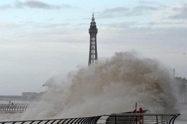
Heavy rain and strong winds hit Lancashire as flood alert issued due to 'high tide forecast'
and live on Freeview channel 276
Outbreaks of rain were predicted to become more prolonged and heavy across Lancashire today (January 5).
Strong winds were also forecast, with the maximum temperature set to reach a chilly 9C.
Advertisement
Hide AdAdvertisement
Hide AdSunday (January 6) was predicted to start better with bright sunny spells, but rain may fall later in the day.
A flood alert covering the Wyre estuary from Fleetwood and Knott End to Little Eccleston was issued by the Environment Agency on Saturday (February 5) as a result.
The alert was issued due to the high tide forecast at around 2.05pm.

Areas most at risk included Tiger's Tail, Wyre Dock, Burrow's Marsh, Burn Naze, Thornton, Trunnah, Stannah, Poulton-le-Fylde, Skippool, Hambleton, Cold Row, Little Singleton, Little Eccleston and Crow Woods.

Advertisement
Hide AdAdvertisement
Hide AdFlooding of low lying land and roads was expected between 12.06pm and 4.06pm.
"After this tide‚ the weather is more settled and no further impacts are expected," a spokesman for the Environment Agency said.
"We will continue to monitor the forecast and re-issue this alert if necessary."
Residents were urged to be careful along beaches, promenades, coastal footpaths and roads due to dangerous large waves.
Advertisement
Hide AdAdvertisement
Hide AdIt is thanks to our loyal readers that we can continue to provide the trusted news, analysis and insight that matters to you.
For unlimited access to our unrivalled local reporting, you can take out a subscription HERE and help support the work of our dedicated team of reporters.