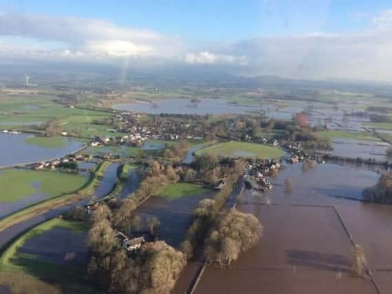
VIDEO: Drone footage of flooding in Lancashire


Wyre Council launched a quadcopter into the sky above St Michaels yesterday, where flooding forced residents to flee their homes.
The remote-controlled machine, borrowed from Balfour Beatty, the company working on Wyre's sea defences, was used to map the water that had inundated the village.
Advertisement
Hide AdAdvertisement
Hide AdThe two-minute video gives a 360-degree view of the situation as emergency services battled to pump the water away.
It shows water-logged fields stretching for miles and buildings completely surrounded by water.
Roads that should be visible are completely underwater in places.
The devastation followed heavy rain as Storm Desmond stuck over the weekend and the flood defences at Hall Lane were breached.
Advertisement
Hide AdAdvertisement
Hide AdAround 45 homes in St Michaels were identified as at risk of flooding and the decision was taken to evacuate roughly half of them on Sunday.
Related stories