
All the traffic-calming measures planned for roads between South Ribble and Preston
Dozens of road changes are being planned between South Ribble and Preston which highway bosses hope will encourage more people to cycle, walk and use public transport.
The traffic-calming measures are part of broader plans to upgrade a series of key junctions on the A582, between Lostock Hall and Penwortham, in order to reduce congestion on the busy route.
However, other local roads connecting the two destinations are also in line for a radical revamp – and the public are being asked for their opinions on those proposals as well.
The so-called “sustainable travel corridor” is centred on the B5254 – Leyland Road and Watkin Lane – but also takes in roads including Cop Lane, Coote Lane and Croston Road.
The routes are commonly used as rat runs to avoid the bumper-to-bumper tailbacks that often blight the A582 during the morning and evening rush hours.
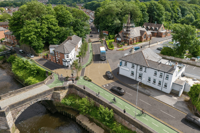

The aim of the overarching plans is to create a more free-flowing A582 and, according to Lancashire County Council, to “discourage through-traffic by using traffic-calming and more pedestrian crossings” which the authority says will “improve road safety and create better local environments with fewer speeding vehicles” and better air quality.
County Hall is also seeking to improve the reliability of bus journeys along the corridor by reducing hold-ups. Passengers will be kept better informed of any delays that do occur via real-time information installed at bus stops.
All of the plans require confirmation of government funding previously earmarked for the wider project – and for which a formal bid will be prepared when the current public consultation is completed.
WHAT’S BEING PLANNED?
The measures for the B5254 corridor and its adjoining routes include:
***Watkin Lane, close to the railway station – speed cushions
***Watkin Lane, north of Moss Lane – raised zebra crossing
***Croston Road, close to Westfield – speed cushions
***Croston Road, near St. Paul’s Park play area – raised zebra crossing
***Croston Road, south of Church Lane/Fowler Road junction – speed cushions
***School Lane, at junction with Croston Road – raised zebra crossing
***Coote Lane and Chain House Lane, from Leyland Road to Penwortham Way – speed cushions
***New Lane/Pope Lane/Cop Lane – speed cushions between Leyland Road and Millbrook Way – speed cushions
***Pope Lane/Cop Lane junction – raised junction and raised zebra crossings
***Pope Lane/Hawksbury Drive junction – raised junction and raised zebra crossings
***Marshall’s Brow/Leyland Road junction – raised zebra crossing on Marshall’s Brow
***Leyland Road, close to Fir Trees Road – removal of southbound bus stop layby and addition of new shelter
***Leyland Road/The Cawsey junction – zebra crossings on Leyland Road (south of the roundabout) and The Cawsey; upgraded crossing points on Leyland Road (north of the roundabout
***Leyland Road to Marshall’s Brow – speed cushions
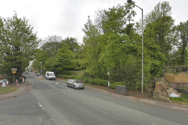
***Leyland Road/New Lane junction – new mini-roundabout
***Leyland Road, south of Brydeck Avenue – removal of northbound bus stop layby and addition of new shelter
***Leyland Road, south of Buller Avenue – puffin crossing replaced with raised zebra crossing
***Leyland Road, south of Hawkhurst Road – new raised crossing point with tactile paving
***Leyland Road – Marshall’s Brow to north of Talbot Road – speed cushions
***Leyland Road/Talbot Road junction – raised table junction
***Leyland Road, close to Penwortham Methodist Church – raised skewed parallel crossing point
***Leyland Road/Riverside Road junction – raised junction
***Leyland Road/Riverside Road junction – raised zebra crossing on Riverside Road
***Leyland Road, north west of Riverside Road – shared use cycleway and footpath
***Leyland Road, from Riverside Road to Fish House Bridge – chicanes with priority for westbound traffic
***Leyland Road, south of Valley Road – raised crossing point
***Leyland Road, between Valley Road and A582 roundabout – parking restrictions
HAVE YOUR SAY
Click here to fill in the survey on the Lancashire County Council website until 21st August.