Penwortham residents want Pickering's Farm housing derailed by lack of link road bridge
and live on Freeview channel 276
The proposals for the route form part of a planning application for 1,100 homes on the Pickering’s Farm site in Penwortham.
However, dozens of locals attending a public meeting into the controversial plans heard claims that the cost of carrying the new highway over the West Coast Mainline meant it was unlikely ever to be completed in full.
Advertisement
Hide AdAdvertisement
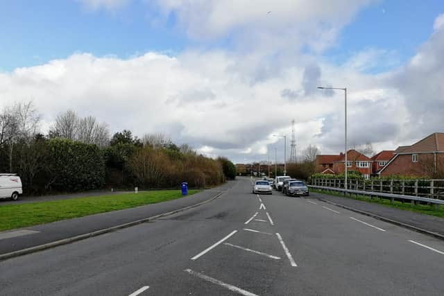
Hide AdThe road is intended to run from Penwortham Way, across the new estate and through to The Cawsey - the site of another recently-completed connecting route, which is soon expected to start carrying traffic from Penwortham through to Walton-le-Dale and the A6. The opening of that road is now a year overdue because of land ownership issues and safety concerns.

But some residents fear that there are more fundamental flaws with the long-planned route to enable the Pickering’s Farm proposals and adjoining developments - which could ultimately see 2,000 properties built in what is currently a countryside area.
“There is no believable prospect of the link road ever being completed as no developer wants to pay millions to build a bridge over the railway,” said Graham Eastham, of the campaign group Keep Bee Lane Rural.
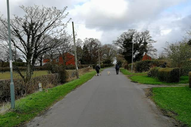
“That means we’ll all be forced to live in a huge cul-de-sac off Penwortham Way with up to 4,000 cars everyday using the lanes to access Lostock Hall. These are single-track lanes that were designed for horses and carts.”
Advertisement
Hide AdAdvertisement
Hide AdFellow Bee Lane resident Phil Hambilton - who has lived on the road for 40 years - branded the plans “a cynical attempt to [secure] access to a housing development”.
A masterplan for the site - now officially known as “The Lanes” - was jointly submitted by developer Taylor Wimpey and the government agency Homes England earlier this year. The document outlines a short and long-term option for where the new road will emerge on the eastern side of the development - along with all the traffic using it.
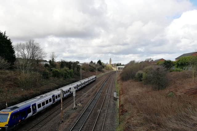
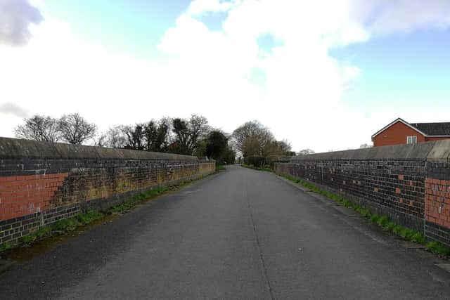
Initially, the route will connect to Bee Lane, shortly before the minor road crosses an existing narrow bridge over the West Coast Mainline. The masterplan states that a number of improvements to the crossing will be considered.
These include the possibility of a controlled single-lane operation of the bridge - or a one-way system, along with upgraded pedestrian facilities over the bridge.
Advertisement
Hide AdAdvertisement
Hide AdAs a longer-term option, the masterplan raises the prospect of building a brand new bridge over the railway to connect directly to the Leyland Road corridor and The Cawsey. But it warns that such a scheme would “require third party land to deliver” - and while it states that the development “would not prejudice” the ambition for a bridge, there is no express commitment to delivering it.
South Ribble Borough Council leader Paul Foster - who stressed that he was offering only his personal comments at the meeting and not speaking on behalf of the authority - also raised concerns about how the surrounding road network would cope with the extra traffic generated by the proposed development.
He called for the completion of separate plans for the A582 to be converted into a dual carriageway before any new properties start to spring up.
“If you have a road that cannot cope with the traffic that is already on it, you can only compound the issue by introducing this new road,” Cllr Foster said.
Advertisement
Hide AdAdvertisement
Hide Ad“In my view, the work [on the A582] would not be completed until 2024/25 - then you could consider building some houses.”

But as the Post revealed last year, the A582 dualling project - set to be delivered as part of the Preston and South Ribble City Deal - currently has an ‘amber’ rating due to “funding uncertainty”. Since then, Lancashire County Council has agreed to prepare a compulsory order to acquire any necessary land for the widening scheme, but planning permission has yet to be secured.
Meanwhile, Highways England - which is responsible for the motorway network and all major trunk roads - has requested more information about the link road plans before it decides whether to object to them. In the agency’s response to the The Lanes masterplan bid, it seeks a series of clarifications about the applicants’ traffic assessment.
They are asked to provide detailed predicted traffic flow information about other planned developments in the area - including the distribution hub at the Lancashire Central site at Cuerden. Highways bosses have also questioned the basis for the conclusion that the Pickering’s Farm site would increase traffic volumes by just 0.2 percent at the M6/M65 interchange and 1.7 percent at the traffic light-controlled roundabout at Lostock Lane and the A6 London Way.
Advertisement
Hide AdAdvertisement
Hide AdAt the public meeting, Cllr Foster set out his fears that the cost of the link road could end up being used as justification for not providing any affordable housing on The Lanes development.
“You have to build roads anyway to move vehicles through a site, so it's a very weak argument,” he said, warning that the authority could not accept proposals that do not include affordable properties.
Taylor Wimpey and Homes England state in the masterplan that it is their intention to provide affordable homes "to the extent to which it is viable to do so". The Post understands that the level on offer will be balanced against requirements to deliver infrastructure such as the cross-borough link road extension.
The application is expected to come before South Ribble’s planning committee early this summer.
‘WATER VOLES HAVE HAD MORE CONSIDERATION THAN US’
Advertisement
Hide AdAdvertisement
Hide AdBee Lane resident Graham Eastham described the plans for The Lanes development as “unprecedented” - because of the intention to build such a large number of houses around an existing small community.
“Right in the middle, there are about 12 of us - and we’ve been totally invisible to the developers,” Mr. Eastham told a public meeting called to discuss the proposals.
“The scoping report for this development was 1,413 pages long - and guess how many pages were devoted to the residents that are going to be built on top of? None.
“And yet water voles got ten pages about the likely impact on them.
Advertisement
Hide AdAdvertisement
Hide Ad“The projected construction phase is 10-15 years, so that means we’re going to have to live in a building site with no prospect of selling up and moving away for the foreseeable future,” said Mr. Eastham, who added that he and his neighbours would be mounting a legal challenge to the proposals on human rights grounds.
The masterplan lays out a development which will contain a new local district centre with shops and services, as well as a new primary school. An interlinked “green infrastructure network” is also promised, possibly including equipped play areas, open space, playing fields and allotments.
The applicants say they have carried out extensive consultation over their plans - and made a number of changes, following exercises undertaken over the past two years. The masterplan document notes that the proposed primary school is now a two-form entry facility and that there will be a no through road for the section of the estate accessed from Chain House Lane - both as a result of feedback.
But one resident dismissed the notion that their voice was being heard by those behind the plans.
Advertisement
Hide AdAdvertisement
Hide Ad“We all know that they’re not [really] consultations - basically, you’re being told what they’re planning to do and they want you to tell them what you will object to if they put that planning application in,” said Caz Kay, who added that she was concerned about the ecological impact of building on Pickering’s Farm.
The majority of the masterplan area is already earmarked for housing under the current South Ribble local plan, with the southern portion identified as so-called “safeguarded land” - which means that it will be released for development at a later date. The entire plot is expected to accommodate 2,000 properties, but the Taylor Wimpey and Homes England application relates only to the about two thirds of the currently allocated site - and will deliver up to 1,100 homes.
South Ribble Borough Council leader Paul Foster told a public meeting that “due process must take its course” and that the authority will continue to act “impartially” over the matter.
Stressing that the authority’s planning officers are not under his control and have a legal duty to which they must adhere, Cllr Foster said that he, personally, could not support “inappropriate development” in the borough.
Advertisement
Hide AdAdvertisement
Hide Ad“And I do think this development is inappropriate,” the Labour leader added.
SUSTAINABLE SITE
The masterplan promises that the site will promote “sustainable” forms of transport, because of the facilities that will be contained within it, its proximity to Lostock Hall railway station and the possibility of a new bus service. Existing public rights of way will also remain accessible.
The document pledges to maintain the existing rural routes as “quiet lanes”, where walking, cycling and horseriding will be encouraged But a resident who already uses the area for the latter purpose said it would be ruined.
“It’s a complete nonsense - you’re not going to be able to ride horses down those lanes when the big cross-borough link road comes in,” the woman said.
‘WE’RE LISTENING TO FEEDBACK’
Advertisement
Hide AdAdvertisement
Hide AdIn response to the issues raised at the public meeting, Taylor Wimpey and Homes England said in a joint statement:
“We appreciate the questions and concerns raised by the existing community regarding plans for The Lanes and want to assure residents that we have taken their feedback on board and will seek to continue to do so.
“We have worked closely with South Ribble Borough Council and Lancashire County Council and consulted with the local community and external stakeholders to ensure our proposals meet the highest possible standards, whilst bringing much-needed new homes to the area. We will be keeping residents updated regularly as plans progress.”
A spokesperson for Lancashire County Council, which is responsible for most of the region’s roads, added: "We will continue to work with South Ribble Borough Council and the developer to advise on highway impacts, including our recommendations for a package of developer-funded improvements as a condition of the development being agreed."
WHERE ON THE MAP?
Advertisement
Hide AdAdvertisement
Hide AdThe masterplan for the Pickering’s Farm site covers an area of land bounded by Chain House Lane and Coote Lane to the south and Penwortham Way to the west. Kingsfold lies to the north of the plot, with Lostock Hall to the east. The primary access will be from a new signal-controlled junction on Penwortham Way, with additional entry points via Bee Lane, Flag Lane and Coote Lane - although access from the latter two roads may be restricted.
Comment Guidelines
National World encourages reader discussion on our stories. User feedback, insights and back-and-forth exchanges add a rich layer of context to reporting. Please review our Community Guidelines before commenting.