Take 555 to enjoy one of the most scenic routes in the country


Stagecoach 555 bus route from Lancaster to Keswick must be one of the most scenic routes in the country taking passengers through the heart of the Lake District. Virtually every stop represents a walking opportunity. You could probably write a book about all the possible walks. In fact someone has. In 2001 Robert Swain issued “55 555 Walks” published by Yan Press. Robert is a writer whose work I know and enjoy but feel he is far too modest in the scope of his guide. Why not “555 555 Walks”? By way of example the route I describe below between Windermere and Ambleside offered three variations that might be considered based on the fitness of the walker and time.
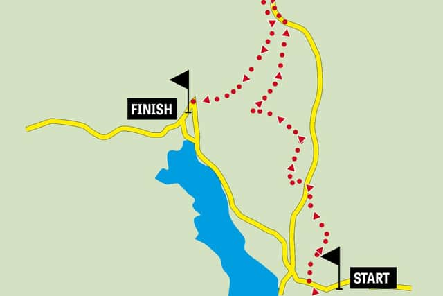
Walk FactsStart: Windermere Railway StationFinish: Ambleside centre – by a southbound bus stop. Distance: 11 milesTime: 4-5 hoursSummary: This is a walk with three climbs and while none are particularly long or arduous they amount to 2200ft of ascent which must grade the walk as strenuous. Map: OS OL7 The English Lakes South eastern area
Advertisement
Hide AdAdvertisement
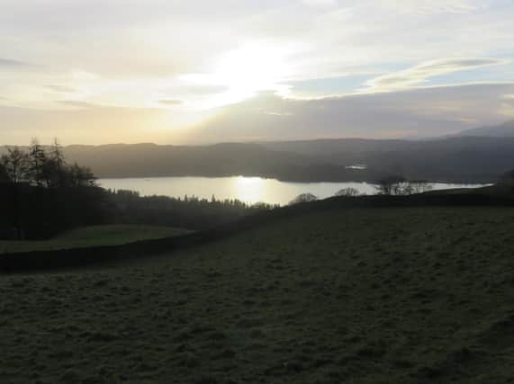
Hide AdDirection: The first part of the walk is a climb to the famous viewpoint of Orrest Head. From the station bus stop walk up to Station Road and turn right. Using the pedestrian crossing to the north of station road cross the busy A591 to access the track up to Orrest Head. This climbs away from the road and village into Elleray Wood on a broad carriageway. Informal paths cut corners here and there but keep on the main path until you reach a brow where the trees begin to thin. Here – if there are no crowds to follow – turn right following a wall to a gateway. From here a clear path leads up to the summit.


This is hallowed ground for Lakeland walkers. It is where Alfred Wainwright had his epiphany on his first visit in 1930. “I was utterly enslaved by all I saw. I gazed in disbelief at the loveliness around me…Everything was wonderful even the rain.” There is a plaque erected by the Wainwright Society to commemorate this moment which changed Wainwright and would later benefit all of us who have come to love the Lake District through his guide books.
To continue follow the beaten path leading northwards from the top. At a wall bear left following the path to a wall junction. Here follow the signpost in the direction of Causeway. After 200yds bear right and keep on the path until it brings you to a lane to the right of Causeway Farm. Turn right. As you reach the next farm (Near Orrest) turn onto a path in front of it in the direction of Far Orrest. The path edges to the right of the far and on the far side after a small gate crosses a field to a stone stile close to a wall corner. Over this follow the wall on your right to the next stile. As you begin to near Far Orrest bear right through a gateway and then go through a small gate on the left with a signpost. Your way is towards Troutbeck which is a continuation of your line of travel. At first on an enclosed track as you reach open space descend to a gate leading onto Moorhowe Road. Turn left. At the next road junction turn right onto a lane that leads down to the A592 Kirkstone Pass Road. (Regular readers may be aware that I seem to be gravitated towards this highway at present!) Turn right and then left onto a bridleway leading down to a handsome and recently constructed footbridge. On the far side follow the path as it climbs up to Troutbeck. Turn right and after passing National Trust property Town End walk along the road to the old post office.
Here is a place of decision. To walk to Ambleside via Robin Lane – clearly signed on the side of the Post Office or to reach it by going over Wansfell another superb viewpoint. The Robin Lane route is relatively straightforward and is certainly easier. Keeping to the main track it will go through High Skelghyll Farm in a little under 1½ miles pass Jenkin Crag yet another famed viewpoint and deposit you at the south end of the town. Alternatively continue along the main street of Troutbeck for almost ½ mile passing three wells on route until you see the footpath sign for Nanny Lane. Turn left on an enclosed Lane that soon leads onto the flanks of Wansfell. Keep on this for almost ¾ mile to where a clearly signed path goes through a gate on the left and takes you to the summit of Wansfell Pike.
Advertisement
Hide AdAdvertisement
Hide AdThe views from here are stunning but on the day we checked out the walk they were obscured by low cloud. C’est la vie! The obvious route continues on a steep downward path bringing you to a private road just above Stockghyll Force. If time and bus timetables allow consider a traverse of the ridge following the wall over its highest part and continuing to the A592. Turn left and as you approach Kirkstone Pass Inn turn left down “the Struggle”. After 500yds turn left on one of my favourite Lakeland footpaths which takes you on a gradual and scenic descent to Ambleside.