Everything a walker desires


The Pennine moorlands around Burnley must be among the most under rated countryside in the UK.
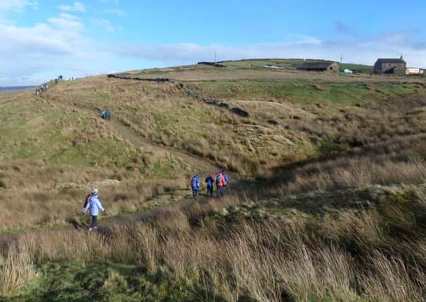
Yet as this thrilling ascent of one of the high hills shows the area provides everything a walker desires – a sense of challenge, wide spaces and tremendous views.
Start: Close to the Ram Cliviger, BB10 4SU. GR SD 875285.
Advertisement
Hide AdAdvertisement
Hide AdDirections: From the Ram continue along the A646 towards Todmordern for almost 500yds (this will necessitate switching sides of the road to make use of the pavement).
Just past a bus stop, turn right onto a woodland drive leading down to a large house. As the drive swings left keep ahead on a track leading down to a footbridge. Follow the path along a walled section to a kissing gate leading out on a grassy hillside. Turn right to climb the path steeply. The path is clear and well waymarked. After three hundred yards it reaches a path junction on a broad shelf below Thieveley Scout.
Bear right (ignoring a waymark post pointing left) and follow a low wall gently climbing above Fishpond Plantation to the right soon with a wall/fence on the right. After 500yds the path meets the Burnley Way on the far side of a deep gully to the left. Turn left through a wooden gate and follow the path steeply up with a fence to the left (this is the strenuous bit). After a track, the path becomes less steep and less clear but maintaining the same direction keep climbing until the trig point comes into sight.
The views cover a wide expanse of the South Pennines and East Lancashire. There follows a superb ridge walk over Deerplay Moor. Cross the fence by a ruined wall at a stile to the left of the trig point, turn right and follow the fence and wall north westwards along the broad moorland ridge. After 800yds the track crosses a stream at the top of Black Clough and then continues to a gate at a junction of walls. Through this keep ahead until you arrive at a wooden gate just before the A671 Bacup Road.
Advertisement
Hide AdAdvertisement
Hide AdTurn right onto the Pennine Bridleway. You now follow this long distance trail as it descends to Holme Chapel. After passing through a wooden gate the track heads briefly north before swinging east above Easden Clough on a broad farm road. Before reaching a gate turn left following the way below the farm at Cow Side. This puts you on a broad green lane. Keep on this to a point where it turns left in front of a wooden gate. Go through the gate (close to a memorial to Mary Towneley) turn left and on a steeper path head downhill with a fence to the left. As you near a farm join a farm track to reach a junction with the Burnley Way.
At a finger post turn right. Keep on a broad track to reach Scout Farm. After the farm the trail continues parallel to the railway before passing underneath it close to Buckley Wood. Soon after this turn left on a broad track leading to Holme Chapel.
Where to eat and drink: The Ram, see www.theramburnley.co.uk, tel: 01282 459091. Since parking is not easy in Holme Chapel it may be an idea to combine a walk with a visit to the Inn (readers should seek permission before the walk).
Points of Interest: The Pennine Bridleway. The National Trail was inspired by the campaign of Lady Mary Towneley of Lancashire who saw the need of a long distance track suitable for horse riders and cyclists. She died about the time the trail was established. In memory of her work a 76 mile circuit was created in the South Pennines and called the Mary Towneley Loop.
Advertisement
Hide AdAdvertisement
Hide AdWalk devised by John Weir of the Burnley Contingent. Described by Bob Clare. For more walks see www.lancashirewalks.com.
Distance: 4½ miles, 7.7k
Time: 2½-3½ hours
Summary: Strenuous to the Pike and then easy
Map: OS OL 21 The South Pennines