Lancashire braces for more thunder and lightning with return of stormy weather on the horizon


As the warm weather continues to grace Lancashire, the Met Office is warning of a repeat of Tuesday night's stormy weather.
With a max temperature of 33 °C expected today (Thursday, July 25), the humid atmosphere is likely to become increasingly unstable.
Advertisement
Hide AdAdvertisement
Hide AdForecasters said temperatures will continue to climb throughout the morning, until the clear skies grow darker in the early afternoon.
A hot and humid afternoon will then give way to thunder and lightning showers at around 3pm.
The storm is expected to continue sporadically through the afternoon, with the yellow weather warning remaining in force until 4am on Friday, July 26.
What to expect
Advertisement
Hide AdAdvertisement
Hide Ad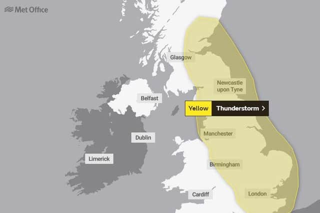
Network Rail are warning that Lancashire's summer heatwave could "flex, bend, and buckle" train tracks. Click here to read more about the warning.
According to the Met Office, the stormy weather could lead to a number of problems, such as:
- Spray and sudden flooding which could lead to difficult driving conditions and road closures
- Flooding or lightning strikes that could lead to delays and cancellations to train and bus services
Advertisement
Hide AdAdvertisement
Hide Ad- Possible power cuts, as well as the loss of other services to homes and businesses

- A small chance that homes and businesses could be flooded, or damaged by lightning strikes, hail or sudden gusts of wind
Outlook for Friday to Sunday
The Met Office said there is likely to be a thundery transition to fresher conditions later on Friday morning.
There will be dry and sunny weather over the weekend, although some brief but heavy showers are possible.