Share the joy and you'll be feeling on top of the world


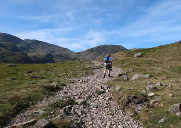
Here’s a suggestion for the post Brexit government (if there will ever be such a thing!) Make a decree for every able bodied English citizen to climb to the summit of Scafell Pike – England’s highest mountain at 3210 feet. This would be the equivalent to a latter day national service – a shared enterprise that might bind our broken nation through common experience. Of course this is just a dream – too many of us think happiness comes out of a screen to ever bother about setting ourselves a physical challenge. And it would be a challenge too. Of the three peaks of Britain Scafell Pike is a tougher climb than either Ben Nevis (4,413ft) in Scotland or Snowdon (3,560ft) in Wales. In part this is due to it is not easily accessible from the more frequented valleys of Langdale and Borrowdale while the character of the ground underfoot demands care by whatever route you choose. Once on the summit plateau the walker has to negotiate a sea of rock which is irksome even in good weather. Nonetheless for those who make the pilgrimage the rewards are immense. They will have immersed themselves in the most dramatic mountain scenery this country has to offer, they would have escaped the incessant noise of our jangling world and had the satisfaction of being momentarily the highest person in England.
WALK FACTS
Start: Seathwaite CA12 5XJ


Distance: 9 miles
Time: 5– 8 hours
Grade: Strenuous
Maps: OS OL 6 The English Lakes North western area (for start and finish) OS OL 5 The English Lakes South western area
DIRECTIONS
Advertisement
Hide AdAdvertisement
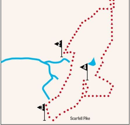
Hide Ad1. From Seathwaite Farm head south through the yard and onto a broad stony track with a stream to your right. In little under ¾ mile reach attractive Stockley Bridge. Cross and keep ahead on a path in the direction of Styhead Tarn as indicated by a signpost. There now commences a climb as you ascend to the hanging valley formed by Styhead Gill. Follow the gill to Styhead Tarn and continue climbing to reach the top of the pass clearly indicated by a mountain rescue stretcher box.
2. This col is one of Lakeland’s most significant crossroads with paths linking Borrowdale and Wasdale and less directly Eskdale and Langdale. At the stretcher box turn left (east) on a path that dips across a boggy area to reach a cairn about 300yds from the pass. Here turn right onto a narrower path that marks the start of “The Corridor Route”. Initially the path loses height as it descends to cross Skew Gill but beyond this it is mainly straightforward as it traverses along the flank of Great End and Broad Crag with superlative views of Great Gable and Lingmell as well as Upper Wasdale. There is one section that is far from straightforward however. This is the “bad step” which is encountered as the path swings left into the cove above Greta Gill. Surprisingly Wainwright in his Pictorial Guide to the Lakeland Fells doesn’t refer to this feature which is a rocky scramble downwards of some 25 feet. There are plenty of hand holds and foot holds so for the experienced fellwalker it would not represent a major obstacle but it would deter those who do not have a head for heights. After this the path continues climbing up to Lingmell Col and then turns left on a very rocky path for the summit of the highest place in England.
3. There is a trig point and a viewing platform nearby and of course a wonderful panorama. You have taken a great deal of effort to get here. Make the most of it. The next section of the walk takes you to Great End which is easier said than done. In terms of distance it is not far – 1 ¼miles but the route involves steep descents to cols below Broad Crag and Ill Crag (the Pike’s neighbouring tops) before crossing the top of Calf Cove to scale Great End. The steep descents are the least of it. The first descent follows a well-worn path which is crumbly underfoot demanding considerable concentration as you negotiate the loose stones. Going over Broad Crag the way is strewn with boulders again requiring focus. It will be a relief to reach Calf Cove and branch off to bag Great End.
4. The awkward crossing is rewarded with sublime views especially to the north where Skiddaw provides the backstop to Borrowdale and Derwentwater. From the summit retrace your steps back to the path from the Pike and turn left descending to Esk Hause (another significant crossroad!) Here take the path leading left that takes you round the flanks of Great End and leads you to the main path connecting Styhead with Langdale. Turn left. After 300 yds arrive at the top of Grains Gill. Here turn right and after crossing Ruddy Gill the path makes the long final descent to Stockley Bridge and Seathwaite.