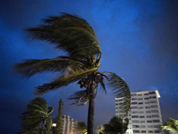
Hurricane Dorian: Storm hits Bahamas with record winds as evacuation ordered in US


The storm's top sustained winds decreased slightly to 180mph while it spun along Grand Bahama island overnight, in what forecasters said would be a day-long assault.
Earlier, Dorian churned over Abaco island with battering winds and surf.
Advertisement
Hide AdAdvertisement
Hide AdThere was little information from the affected islands, but officials expected many residents to be left homeless.
Most people went to shelters as the storm approached, with tourist hotels shutting down and residents boarding up their homes.
"It's devastating," said Joy Jibrilu, director general of the Bahamas' Ministry of Tourism and Aviation. "There has been huge damage to property and infrastructure. Luckily, no loss of life reported."
On Sunday, Dorian's maximum sustained winds reached 185mph, with gusts of up to 220mph, tying the record for the most powerful Atlantic hurricane ever to come ashore. It equalled the Labour Day hurricane of 1935, before the storms were named.
Advertisement
Hide AdAdvertisement
Hide AdAs of early Monday, the hurricane's westward movement had slowed somewhat to 5mph.
Forecasters said Dorian was most likely to begin pulling away from the Bahamas early on Tuesday and curve to the north-east parallel to the US Southeast seaboard.
Still, the potent storm was expected to stay close to shore and hammer the coast with dangerous winds and heavy surf, while authorities cautioned that it could still make landfall.
South Carolina Governor Henry McMaster ordered a mandatory evacuation of the entire coast of the state amid Dorian's threat. The order, which covers about 830,000 people, goes into effect at noon local time on Monday, when state troopers will begin reversing lanes so they all head inland on major coastal highways.
Advertisement
Hide AdAdvertisement
Hide Ad"We can't make everybody happy," Mr McMaster said. "But we believe we can keep everyone alive."
Georgia's governor Brian Kemp also ordered a mandatory evacuation of the state's Atlantic coast, also starting at noon on Monday.
Authorities in Florida ordered mandatory evacuations in some vulnerable coastal areas.
More than 600 Labour Day flights in the US had been cancelled as of Sunday afternoon, many of them in Florida as Dorian barrelled towards the state's coast.
Advertisement
Hide AdAdvertisement
Hide AdThe only recorded storm that was more powerful was Hurricane Allen in 1980, with 190mph winds. That storm did not make landfall at that strength.
"Catastrophic conditions" were reported in Abaco, with a storm surge of 18-23 feet (5.5-7 metres), and Dorian was expected to cross Grand Bahama later in the day "with all its fury".
In the northern stretches of the archipelago, hotels closed, residents boarded up homes and officials hired boats to move people to bigger islands.
Video that Ms Jibrilu and government spokesman Kevin Harris said was sent by Abaco residents showed homes missing parts of their roofs, downed power lines and smashed and overturned cars. One showed floodwaters rushing through the streets of an unidentified town at nearly the height of a car roof.
Advertisement
Hide AdAdvertisement
Hide AdIn some parts of Abaco, "you cannot tell the difference as to the beginning of the street versus where the ocean begins", said Prime Minister Hubert Minnis.
According to the Nassau Guardian, he called it "probably the most sad and worst day of my life to address the Bahamian people".
Earlier, Mr Minnis had warned that anyone who did not evacuate was "in extreme danger and can expect a catastrophic consequence".
The government opened 14 shelters across the Bahamas. Dozens ignored evacuation orders, officials said.
Advertisement
Hide AdAdvertisement
Hide AdAfter the Bahamas, the slow-crawling storm was forecast to turn sharply and skirt toward the US coast, staying just off Florida and Georgia on Tuesday and Wednesday and then buffeting South Carolina and North Carolina on Thursday.
The National Hurricane Centre issued a hurricane watch for Florida's East Coast from Deerfield Beach north to the Volusia and Brevard county line. The same area was put under a storm surge watch. Lake Okeechobee was under a tropical storm watch.
Florida governor Ron DeSantis warned the state's densely populated Atlantic coast: "We're not out of the woods yet."
He noted that some forecast models still bring Dorian close to or even onto the Florida peninsula.
Advertisement
Hide AdAdvertisement
Hide Ad"That could produce life-threatening storm surge and hurricane force winds," he said. "That cone of uncertainty still includes a lot of areas on the east coast of Florida and even into central and north Florida, so we are staying prepared and remaining vigilant."
Mandatory evacuation orders for low-lying and flood-prone areas and mobile homes were in effect starting either Sunday or Monday from Palm Beach County north to at least the Daytona Beach area, and some counties to the north issued voluntary evacuation notices.
On Tuesday and Wednesday, Dorian is forecast to be 40 to 50 miles off Florida with hurricane-force wind speeds extending about 35 miles to the west.
National Hurricane Centre director Ken Graham urged residents not to bet on safety just because the specific forecast track has the storm just a bit offshore.
Advertisement
Hide AdAdvertisement
Hide AdComplicating matters is that with every new forecast, "we keep nudging (Dorian's track) a little bit to the left" which is closer to the Florida coast, he said.
Dorian is a powerful but small storm with hurricane force winds on Sunday only extending 29 miles to the west, but they are expected to grow a bit. That makes forecasting its path delicate and difficult.