Medieval cross design brought back to Leyland green space saved by campaigners


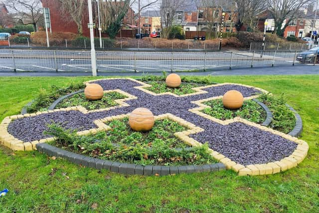
A cross design made from stone spheres, cobblestones, gravel and low-lying shrubbery is in place in Balcarres Green, Leyland, thanks to South Ribble Council.
The cross was chosen because on old maps of Leyland - up to 1906 - a medieval cross was depicted at the site.
Advertisement
Hide AdAdvertisement
Hide AdThe work has been hailed by locals, many of whom campaigned to save the Green from being used for housing development.
Barbara Bidwell said: "It’s looking great and reflects the history of the area".
Susan Jones said: "What a lovely feature- looks great!"
Leyland Central Councillor Aniela Bylinski Gelder said: "It certainly looks better than houses and apartments, driveways and cars. Well done!"
In 2019, South Ribble Borough Council were investigating the possibility of releasing the open spaces on Bent Lane and at Balcarres Green for affordable living.
Advertisement
Hide AdAdvertisement
Hide AdBut 1,500 people signed a petition in objection, and the Labour opposition group made it one of their main campaign pledges to rule out development in the two locations.
Once in power, Labour made good on their promise, and Council leader Paul Foster declared it "an all round success story for our local communities – they demanded action on these spaces and we delivered".
The council then agreed to include the two spaces in its Green Links programme - designed to improve existing and create new green features across the borough, such as parks and local green spaces and will provide improved links between them, such as signposted cycle and walking paths.
The history of the cross:
Early maps show a cross on this site, although the exact location varies, implying that the cross may have been moved over the years.
Advertisement
Hide AdAdvertisement
Hide AdOn some maps it is marked as a cross, later maps just mark the site of the pedestal. It is last shown on the 1906 map.
Standing half a mile north of St Andrew’s Church, it is referred to as Sandy Lane Cross, as the road running adjacent to the area, prior to the construction of Balcarres Road, was called Sandy Lane. The southern end of Sandy Lane still retains its name.
Medieval Crosses were erected during the mid-10th to mid-16th centuries, usually made of stone. It is thought that they numbered in excess of 12,000 during this time, though fewer than 2,000 medieval standing crosses are known to remain. The original purpose of this cross is not known but they were erected for several reasons, including as boundary markers, as a place to preach or pray, as the site of a market, and as a burial site for those not able to be buried in the churchyard.
Whilst doing improvement works on the Green, the entrance to an old air raid shelter was discovered. This has long since been filled in but explains the rise in ground level behind the hedge