Map released showing where to avoid around Winter Hill
This article contains affiliate links. We may earn a small commission on items purchased through this article, but that does not affect our editorial judgement.


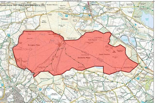
Bolton Mountain Rescue Team (BMRT) posted the map to its social media channels along with a message to walkers.
A spokesman said the map "shows the areas that have been affected by the fire and where Lancashire Fire and Rescue Service need people to stay clear from".
Advertisement
Hide AdAdvertisement
Hide AdThey added: "This cordon is not only for public safety but it will help ensure they can maintain the momentum and progress they've made so far.
"This will help them give you back full access to the moors as soon as possible."
The map has been released as the fire on Winter Hill continues to smolder more than a week since it ignited.
Yesterday the London fire service sent 36 firefighters and six engines to Lancashire to help fight the blaze.