Escape the festive frenzy and head for a local haven


Cuerden Valley Park is a precious emerald surrounded by increasing urban development. As a country park it is differently managed from places such as Witton Park and Beacon Fell being run by a trust rather than a local authority. Its 650 acres were originally part of the estate of Cuerden Hall one time home of the Towneley Parker family (Cuerden Hall is now a Sue Ryder nursing home caring for people with complex neurological conditions).
It is thanks to the Trust and the voluntary effort of a friends group that Cuerden Valley Park has managed to withstand the pressures of modern life to offer a haven for wildlife and a place for people to exercise and relax.
Advertisement
Hide AdAdvertisement
Hide AdBroadly the park is a green corridor between Wigan Road (A49) and the A6 running north to south following the course of the River Lostock for about 2½ miles. At its widest it is about half a mile. There are three main sections. To the north there is a remnant of open space created after the building of the M65 extension in the early 1990s (neither the Trust or Swampy and his tree dwellers were able to prevent this motorway being routed through the park). The central section of the park is where the visitor centre is based – close to Cuerden Hall. The southern part running from Town Brow (B5256) continues towards Chorley. Earlier this year reader John Hargreaves described a walk from the visitor centre taking in the central section. The walk below explores the southern end of the park. As we are in the school Christmas break it would make for a splendid family outing.
Walk Facts
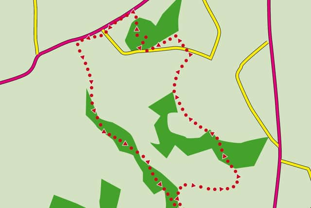
Start/finish: Lower Kem Mill Car park, Cuerden Valley Park accessed from the A6 Whittle-le-Woods. PR6 7HS. (Pay & Display)
Distance: 3 miles
Time: 2 hours
Grade: Easy
Map: OS Explorer 285 Southport and Chorley. This map will give you an overview but it may be easier to use the map on the Park’s information leaflet which shows the main paths. On route there are three information boards each with a large map which will allow you to orientate yourself should you become confused by these directions.
Directions
From the car park return to the entrance and turn left in front of the allotment. Pass through a gate to enter the park proper. After 300yds the path passes a large pond on the right just one of the numerous habitats the park manages. Just beyond the pond reach a junction where NCN Route 55 from Chorley joins the main path. Turn right here briefly off a defined path to reach a footbridge across the River Lostock. This area was once the site of Lower Kem Mill a printworks destroyed by fire in 1914. The ruins are mainly to the right as you approach the bridge.
Advertisement
Hide AdAdvertisement
Hide AdCross the bridge and follow the narrow enclosed path uphill through fields. When you reach a kissing gate on the edge of a housing development bear left still climbing and soon after enter woodland predominantly beech. The route now edges along the eastern side of the park with housing developments to your right. The paths are well defined and maintained so route finding should be unproblematic. Failing this check with the numerous dog walkers you are likely to encounter (you are heading for the Ley Inn). Emerging from the woods cross a road end and continue along a less wooded path. After crossing an estate road (Lostock Meadow) reach a junction with a dog waste bin on the left. The left fork will take you down to the River Lostock and offers a short cut should the weather turn bad. On this walk go right on a path that soon is flanked on the right by back garden fencing. Keep on the track as it brings you to Back Lane opposite the Ley Inn.
Turn left on Back Lane and 50yds from the Ley Inn’s car park cross to re-enter another segment of the park. When you reach a junction of paths turn left downhill on a course that’s parallel to Back Lane. After passing an entrance to the left the path begins to climb to reach open space. Still climbing continue to a path junction and then turn left soon after passing a wooden bench and an inviting picnic stop. After this keep on the path to the next junction and turn left to arrive at a flight of steps leading down to Sheep Hill Lane. When you reach it turn left. Crossing Back Lane you find yourself opposite Town Brow Car Park another of the Park’s main entrances. Keep ahead to cross the River Lostock and then turn left onto the cycleway. This will take you back to Lower Kem Mill on an easy and pleasant route without any navigational difficulties. After passing a wooded brow the path descends to river level. Here at a junction keep right.
- Walk checked out by Frank Clare and described by his granddad Bob Clare