Weekend walk: Settle


The Settle-Stainforth walk for Barden High School’s Year Eight activity day was a masterpiece in logistics. The year was divided into four parties. Two were dropped off in Settle and then the coach went on to Stainforth with the remaining pupils and staff.
From their respective start points the two groups would set out on a circuit in opposite directions – clockwise and anti-clockwise. Once the Stainforth parties were back the coach went down the valley to pick up at Settle en route back to Burnley.
Advertisement
Hide AdAdvertisement
Hide AdIt was a great day out. Not only were the young people given the benefits of exercise and fresh air but almost incidentally they had lessons in physical and human geography, geology and history.
Outdoor education has been squeezed out of the results fuelled curriculum in many of our state schools (but significantly not in the independent sector) and because it is fun it does not look like learning.
Yet ask most people what they remember about their school days nearly all will recall the school trips – especially those involving outdoor activity.
WALK FACTS
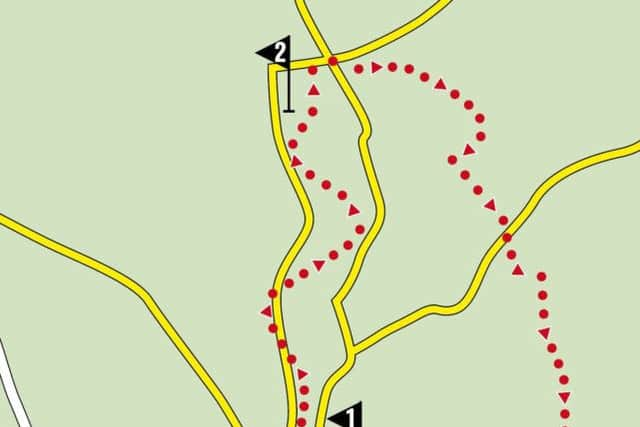
Start: Settle Whitefriars car park, BD24 9JD The route described below goes in an anti-clockwise direction.
Distance: 8 miles
Time: 4–5 hours
Advertisement
Hide AdAdvertisement
Hide AdGrade: Most of the walk is easy but the first 1 ½ miles involves a sustained climb away from the town.
Maps: OS OL2 The Yorkshire Dales Southern & Western areas
DIRECTIONS
1.From the car park turn right towards the town centre. At the market square turn left and continue to Constitution Hill which steeply climbs away from the town and downgrades to a stony farm track. Now on the Pennine Bridleway keep on it in the direction of Langcliffe until you come to a junction of paths ¼ mile after the edge of the town. Here turn right on a steep grassy path leading to a gateway. Through this and you enter dramatic limestone country almost reminiscent of a John Ford western. To the left the heights of Warrendale Knotts form a wall above the dry valley the route passes through. Ahead Attermire Scar creates an impressive backdrop as the path drops to the remains of what use to be a shooting range. Remnants of rusting targets punctured with alarming shell holes can still be seen. Beyond this the way is left climbing through a rock strewn pasture to a small gate in the wall. Through this continue northwards for a little under ½ mile to reach a path on the right leading up to Victoria Cave. This cavern was discovered in 1837 the year of Queen Victoria’s coronation. Returning to the main path continue to a kissing gate leading down to a broad farm track. Turn right. After 150 yards cross a ladder stile on the left. After a short distance as you reach a broad grassy path turn right following it to a small gate in a wall. Through this keep ahead to gently descend to a quiet unfenced road. Turn right, cross a cattle grid and turn left on to a farm road which leads to Upper Winskill Farm. Just before the complex turn right on a farm track in the direction of Stainforth following the Pennine Bridleway. After crossing the corner of an enclosure the track swings left through a gate and descends to Stainforth. It would be remiss however not to visit Catrigg Force which is sign posted to the right of the main track just after a wooden gate. The best view of the waterfall is from the wooded ravine below accessed by a path to the left of the upper fall.
2. As you enter the village keep straight to cross Stainforth Beck over a set of stepping stones. Turn left on Goat Lane and then right at the next junction to join Church Lane. This passes St Peter’s Church to arrive at the Settle – Horton Road B6479. Turn right. In a little under 200 yards turn left on to a narrow lane that crosses the Settle-Carlisle Railway and then descends to the Ribble Way. Cross what in retrospect is a most attractive bridge and then turn left on to the riverside path taking you to another waterfall – Stainforth Force. This suffers somewhat by comparison with the great (60ft) drop of Catrigg Force but is nonetheless a dramatic spectacle after (and during) wet weather. Now on the Ribble Way the direction is to follow it all the way back to Settle. For most of the leg it stays in close contact with the river but at the weir close to Langcliffe Mill it briefly moves away when the path turns right taking you into the hamlet of Stackhouse. Here turn left to follow the lane for ¼ mile when a footpath on the left takes you across fields to the edge of Settle as heralded by the playing fields of Settle High School.
- Walk devised by The PE and Humanities departments Barden High School Burnley.
- Bob’s walks are now available as digital guides on the iFootpath website and App (see iFootpath.com).