Rocket - or ramble! - up Stephenson's right of way


The Pennine Way, Britain’s first long distance path was the brainchild of a Lancashire man – Tom Stephenson born to a working class family in Whalley in 1893. As a journalist he wrote an article in 1935 for the Daily Herald which called for the establishment of a trail along the backbone of England in a similar fashion to the Appalachian Trail in America which was at that time in the final stages of completion. Stephenson pointed out that the A.T. gave hikers over 2,000 miles to follow while in England access to the countryside was severely restricted by private ownership of land. A long distance path in England would not be longer than 300 miles. Stephenson went on to champion the creation of National Parks and in 1965 saw the opening of the Pennine Way.
The Pennine Bridleway too has strong Lancashire connections. Before going on to describe these it may be worthwhile to point out the differences between a public footpath and public bridleway. Both are Rights of Way in that use of them is protected by law. A public footpath allows a legal right to access on foot. Where conditions allow prams and wheelchairs can use public footpaths as well as dog walkers providing the animal is on a lead. If there is an obstruction on the public footpath a walker is entitled to take a short alternative route. Public footpaths are signed by yellow waymarks and are characterised by stiles, kissing gates and footbridges. On an Ordnance Survey map public footpaths are marked by green short dash lines.
Advertisement
Hide AdAdvertisement
Hide AdAs the name suggests a Public Bridleway extends the right to pass and re-pass on foot to horse riders and to cyclists (though the ground may not always be suitable for them). On OS maps public bridleways are marked by green long dash lines. In practical terms public bridleways tend to be broad tracks using gates rather than stiles and are waymarked by light blue arrows or markers. They are predominantly used by walkers.
Perhaps because of this there was a time when they went through a period when they were not sufficiently maintained to offer amenity for horse riders. Lady Mary Towneley a keen equestrian became so concerned with the state of public bridleways in 1986 she rode on horseback from Corbridge in Northumberland to Ashbourne in Derbyshire a distance of 250 miles to raise public awareness. From this venture the feasibility of a national trail for horse riders came into being so that the Pennine Bridleway was developed in the late 1990s. Sadly Lady Towneley died of cancer in 2001 before the new national trail was completed but in her honour a 47 mile loop named after her was opened in 2002 the route running close to the family home in Cliviger.
Tom Stephenson and Mary Towneley came from different backgrounds; his, working class and socialist, hers one of privilege. They lived their lives over a generation apart. Yet both shared a passion for the outdoors a passion that was formed through exploring the diverse countryside of Lancashire especially its upland areas. And because of their inspiration countless others have benefited. The walk described below follows the Pennine Bridleway on the edge of the Yorkshire Dales National Park.
Walk Facts
Start. Long Preston Village Green on north side of A65 BD23 4PH
Finish: Settle town centre
Distance: 4 miles
Time: 2 – 3 hours
Advertisement
Hide AdAdvertisement
Hide AdGrade: Moderate. The walk (or ride ) involves 500ft of ascent but is never steep.
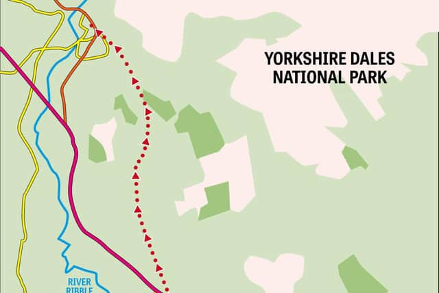
Map: OS OL2 Yorkshire Dales Southern and Western areas
Horseless readers will need to sort out the logistics of this linear route either using public transport – a bus or train from Settle to Long Preston or two cars. There is roadside parking close to Long Preston railway station.
Directions
From the village green turn into School Lane and almost immediately turn left onto Green Gate Lane. Put the map away – you won’t need it for the next three miles until you arrive on Mitchell Lane. For the first mile the route is on tarmac gently climbing between fields until you arrive at a small car park marking the end of the lane. From here a broad track continues into a patch of moorland close to the highest part of the walk at around 1000ft. After this the track drops down to skirt Black’s Plantation and reach Mitchell Lane. From here turn left for Settle. Should this walk prove too short it can easily be extended by turning right onto an enclosed track marked Lambert Lane and following this round to Stockdale Lane. Once again a left turn leads to Settle but it would be remiss not go just a mile further by turning right and then left onto a footpath towards Attermire. Now on a public footpath and not a bridleway the route climbs a rise and then after skirting shapely Sugar Loaf Hill descends to a dry valley below Warrendale Knotts. Go left here for Ribblesdale and Settle amidst the most spectacular limestone scenery the national park has to offer.
- Walk inspired by Lady Mary Towneley